
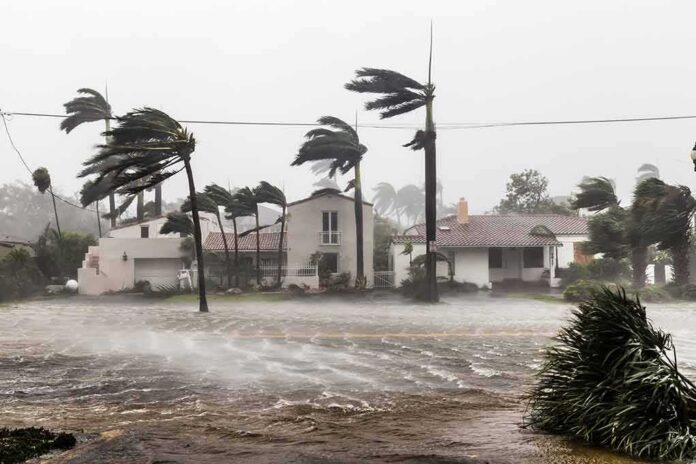
Hurricane Isaias gained strength as it churned toward the northern Gulf Coast, and forecasters warned it could still get worse before it made landfall.
Quick Take
- The National Hurricane Center said Isaias was expected to strengthen through early Friday before reaching the coast.
- Storm surge, hurricane, and tropical storm warnings covered a long stretch from Louisiana to the Florida Panhandle.
- Forecasters warned of damaging winds, heavy rain, and flooding across Florida, Alabama, and Mississippi.
- Track forecasts from the Hurricane Center are historically more reliable than individual computer models, though intensity can shift fast.
Forecasters Tracked A Storm On The Rise
The National Hurricane Center said Isaias was gaining strength and would likely stay a dangerous hurricane as it closed in on the northern Gulf Coast Friday night. Advisories pointed to landfall late Friday or that night, somewhere within the warning zone stretching across the coastline. Forecasters watched the storm’s wind field grow, a sign that the system was organizing instead of falling apart over open Gulf water.
Some reports flagged top winds near 110 miles per hour as a real possibility, which would push Isaias into Category 2 territory. That kind of wind can rip off roofs, snap power poles, and send debris flying for blocks. Coastal residents from Louisiana to Florida got the message early: this was not a storm to shrug off, even if the exact landfall spot still carried some uncertainty.
Warnings Stretched Across Three States
Officials posted a storm surge warning from the mouth of the Mississippi River to Florida’s Steinhatchee River. A hurricane warning covered the coast from Ocean Springs, Mississippi, to the Bay and Gulf County line in Florida, with tropical storm warnings filling in the gaps on either side. That kind of layered warning system tells coastal families exactly how bad the wind and water could get in their specific stretch of shoreline.
Forecasters also flagged a separate danger many people overlook during hurricane coverage: rain. From Friday through the weekend, the storm was expected to dump heavy rainfall across the central Gulf Coast, raising the risk of inland flooding far from the beach. Wind damage grabs headlines, but flooded roads and swamped homes often cause more lasting harm to families and small businesses.
Why The Threat Kept Growing On Approach
Hurricane forecasting is a game of probabilities, not guarantees, and that reality shaped how Isaias coverage unfolded. The Hurricane Center displays storms using a forecast cone that shows a range of likely paths, not a single locked-in line, yet many people read it as an exact prediction. That gap between how experts communicate risk and how the public hears it shapes a lot of hurricane season confusion every single year.
Two forces mostly drive how much a storm like Isaias can intensify or weaken on short notice: wind shear and the amount of moisture in the surrounding atmosphere. When shear is low and moisture is high, a storm can strengthen quickly, catching coastal communities off guard if they waited too long to prepare. That is exactly why officials pushed hard for early action instead of a wait-and-see approach along the Gulf Coast.
Hurricane Isaias is gathering strength Thursday morning despite persistent crosswinds, raising the threat of damaging winds and flooding across a wide stretch of the US Gulf Coast https://t.co/KwKJEoc6hx
— Bloomberg Green (@climate) October 8, 2026
None of this means forecasters get it wrong. The National Oceanic and Atmospheric Administration notes that official Hurricane Center track forecasts are, on average, more consistent and carry lower errors than individual global computer models. For a storm like Isaias, that track record gave residents and emergency managers a solid reason to trust the warnings and prepare their homes, boats, and evacuation plans well before the winds arrived.
Sources:
washingtontimes.com, nhc.noaa.gov, star.nesdis.noaa.gov
© standardnewsdaily.com 2026. All rights reserved.