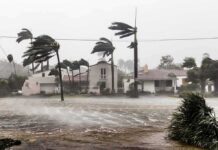
A rare polar vortex split, the earliest in 70 years, threatens to unleash weeks of brutal Arctic cold across North America and Europe, defying mild winter forecasts.
Story Snapshot
- November 2025 Sudden Stratospheric Warming (SSW) triggered vortex split into North American and Asian cores.
- Arctic air corridors open, projecting frigid temperatures through January and into February 2026.
- Historical analogs from 1958, 1968, 2000 confirm prolonged cold outbreaks from early splits.
- Current stretch displaces vortex over Canada, hitting US Midwest and East hardest next week.
- Weak La Niña and negative NAO amplify risks, challenging seasonal models.
Polar Vortex Mechanics and November Trigger
The polar vortex forms a persistent low-pressure cyclone of frigid Arctic air, encircled by the Polar Night Jet’s westerly winds from temperature gradients. Planetary Rossby waves, amplified by Rockies and Himalayas topography, propagate upward in November 2025. These waves break in the stratosphere, slowing the jet stream. High-pressure anti-vortices then deform the vortex, causing core split by late December. Zonal winds reversed at 60°N and 10 mb level, meeting major SSW criteria—the earliest in seven decades.
Timeline of Vortex Disruption and Cold Surge
Late November SSW indicators emerged with rapid polar temperature rises. December high-pressure anomalies propagated downward, splitting the vortex into dual cores over North America and Asia. Late January 2026 brought a distorted oval-shaped vortex stretching toward the US, funneling Arctic air into central and eastern regions. Canada faced displacement cold first. Early February models forecast potential SSW collapse with over 50°C anomalies, signaling renewed outbreaks despite some softening predictions.
Current Status and Forecast Conflicts
As of late January 2026, the vortex distorts and stretches over Canada and North America, not fully split per latest guidance. Arctic air grips central and east US for five days, sparing Southwest and Florida. A January Nor’easter bombed the East Coast. Mid-February signals blocking highs and Arctic corridors. NOAA CPC notes neutral AO with East warming and West wetter trends. H24 maintains split cores prolong cold, creating forecast tension between sensational models and conservative outlooks.
Weak La Niña cools the Pacific, easterly QBO boosts poleward wave energy, and negative NAO locks Greenland blocking. These synchronize stratospheric-tropospheric coupling, amplifying cold beyond typical displacements. Direct Arctic corridors differ from mere shifts, promising deeper freezes aligned with historical precedents.
Impacts on US Communities and Economy
Midwest and East US, including hard-hit Minnesota, face frigid temps and winter storms next 5-14 days. Canada endures prolonged outbreaks. Northern Europe shivers while south stays mild. Energy demand spikes strain grids and raise heating costs. Transport halts from storms like the record Nor’easter. Agriculture risks crop damage; insurance tallies claims. West gains beneficial snowpack ending drought, a silver lining for water supplies. Unprepared regions test social resilience.
Expert Views and Conservative Outlook
H24 Weather News labels the split a “Polar Express” with negative NAO locking cold. Severe-weather.eu and Futura-Sciences predict true Arctic air via SSW splits. FOX Weather and CPC evolve to stretching with neutral AO, eyeing East warming. Sven Sundgaard warns Minnesota of max stretch risks in February. Facts favor NOAA’s conservative stance—common sense demands preparation over hype, prioritizing safety amid model uncertainties.
Sources:
Polar Vortex Collapse: Why February Is Shaping Up to Be Weather Chaotic
Polar Vortex Extreme Cold Spell East February Outlook
Polar Vortex is Stretched to the Max; Minnesota Could Get Hit Hard Again in February